Tjukurpa · living Anangu law Gates from 5:00 am, seasonal A$38 · 3 days · under-18s free Base walk · 10.6 km around Handback Day · 26 Oct
The desert announces it long before the road does: a single shape on the horizon, glowing through the haze. Up close the rock is not smooth at all. It is folded and scarred, streaked black where waterfalls run after rain, honeycombed with caves. Desert oaks whisper along the track, and the light moves from ochre to ember as the day turns. Anangu have lived under this rock since the beginning of their law. You do not climb it. You walk beside it.
This is Anangu land. The Yankunytjatjara and Pitjantjatjara traditional owners hold the title deeds, and the park is jointly managed by a board with an Anangu majority alongside Parks Australia.
Tjukurpa, the traditional law, stories and spirituality of the Anangu, is not an abstract idea: it lives in the land and the people. Every cave, waterhole and fold of the rock records the journeys of ancestral beings, and many of those stories are not for public telling. This page honors that silence.
One of the few places on earth holding dual UNESCO World Heritage listing: inscribed in 1987 for its natural values, and again in 1994 for the living cultural landscape of Anangu, one of the oldest societies on earth.
The law, and the land that came home
Anangu tell that in the creation time ancestral beings crossed this country and shaped it as they went, leaving their marks in the rock and their law for the people to keep. At the southern face, tradition holds, Kuniya the woma python woman fought a deadly battle with Liru the poisonous snake man, and the story is still written on the stone above Mutitjulu Waterhole, where her spirit remains. These are the tellings Anangu choose to share. Many more belong only to the right people, in the right place, and are not repeated here.
For most of a century the rock was mapped, named Ayers Rock, and climbed by strangers. Then, on 26 October 1985, before more than 2,000 people gathered on the red plain, Governor-General Sir Ninian Stephen placed the title deeds in Anangu hands. The traditional owners leased the park back to the national parks service for 99 years, and since that day, known simply as Handback, a Board of Management with an Anangu majority has governed it jointly with Parks Australia.
Anangu had long asked visitors not to climb: from the 1990s, signs at the base read Please Don't Climb. In November 2017 the Board voted unanimously to close the climb, and on 26 October 2019, the 34th anniversary of Handback, it closed for good. Sammy Wilson, then Board chairman, said the land has law and Culture, that tourists are welcome, and that closing the climb was not something to feel upset about but a cause for celebration.
What you'll actually see
1
Mutitjulu Waterhole
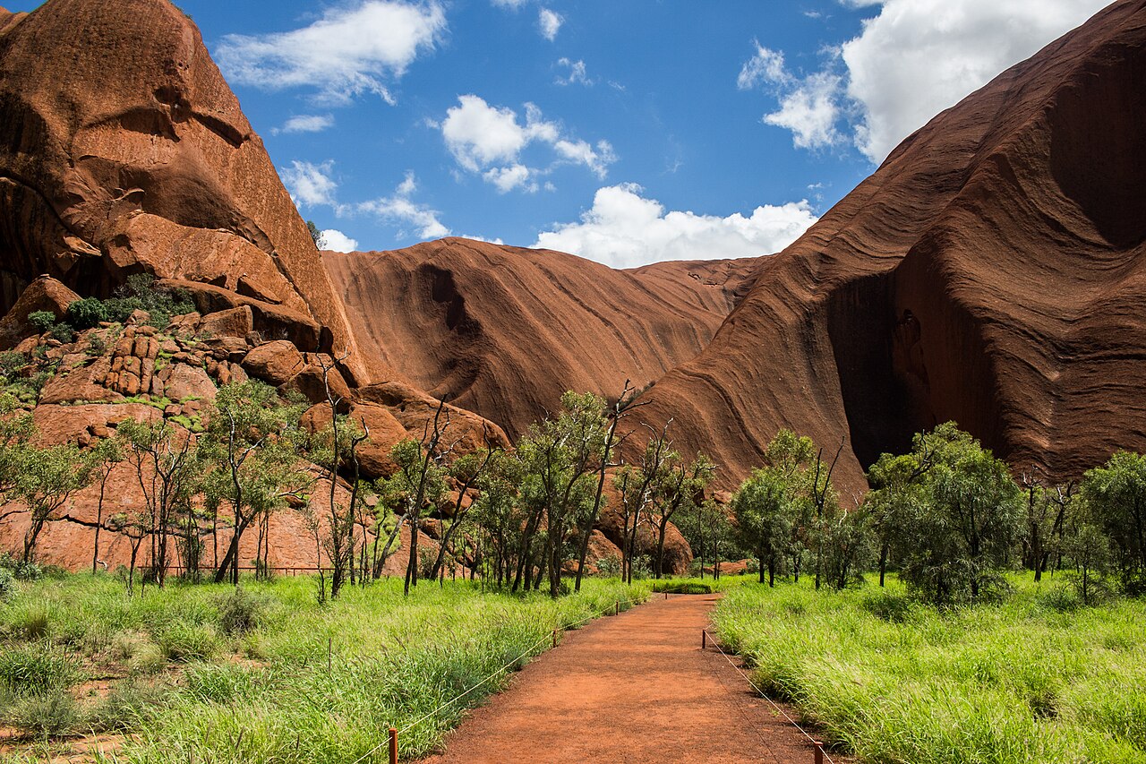
At the end of the gentle 1 km Kuniya walk, one of the few permanent water sources around Uluru sits in a fold of sheer stone, ringed by river red gums and tall grasses where wallabies shelter. Nearby, the Kulpi Mutitjulu rock art cave holds generations of painted teaching.
2
The Mala walk
A 2 km stretch along the north-west face, past wave-shaped caves and seasonal waterfall stains, on the same path the free ranger-guided Mala walk follows every morning. Rangers and Anangu share the park's geology, natural environment and cultural heritage as you go.
3
Talinguru Nyakunytjaku
The main sunrise viewing area, with shade shelters, viewing platforms and kilometres of walking track facing the rock across the dunes. Come at dawn to watch the surface turn from shadow to deep rust, or at dusk to have it almost to yourself.
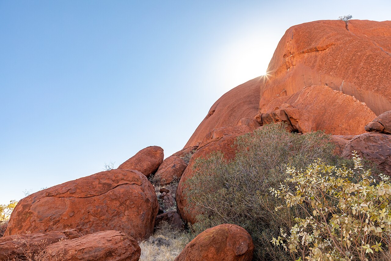
Mutitjulu Waterhole, a permanent pool at the base of Uluru ringed by pale stone and desert treesThe Kuniya walk path approaching the folded southern face of Uluru
Mutitjulu Waterhole and the Kuniya walk · photos CC BY-SA 4.0 Coen Hird and Dietmar Rabich, Wikimedia Commons
THE DAY THE LAND CAME HOME
Handback Day · 26 October
On 26 October 1985 the title deeds to this land were returned to Anangu in a ceremony watched by more than 2,000 people, and the traditional owners leased the park back to the national parks service for 99 years under joint management. Exactly 34 years later, on 26 October 2019, the climb to the summit closed permanently at the Anangu's request, a decision the Board of Management had made unanimously in November 2017. October 2025 marked forty years since Handback.
Visitors today walk around the rock, never up it: the 10.6 km base walk is the way this country asks to be known.
Plan your visit
By air
Ayers Rock Airport (AYQ) at Yulara has direct flights from Sydney, Melbourne, Brisbane and Cairns; the rock is about 20 km by road from the resort town.
By road
465 km from Alice Springs, about 5.5 hours of sealed highway; hire cars are available at the airport, Yulara and Alice Springs, and book ahead.
Park hours
Seasonal: gates open 5:00 am in summer (December to February) and 6:30 am in mid winter (June to July); closing ranges from 7:30 pm to 9:00 pm.
Entry
A$38 per adult, valid 3 days; children and teenagers under 18 free; annual pass A$50.
Base walk
10.6 km loop, about 3 hours 30 minutes, Grade 3. Start from the Mala carpark in the cool of early morning; in hot weather finish before 11:00 am.
Mala walk
Free ranger-guided walk daily at 8:00 am October to April and 10:00 am May to September.
Sunrise & sunset
Talinguru Nyakunytjaku has platforms and shelters for sunrise; the car sunset viewing area faces the glowing western side in the evening.
Cultural Centre
Open 7:00 am to 5:45 pm daily inside the park; allow two hours for the Tjukurpa displays and the Maruku Arts and Walkatjara Art galleries.
Anangu, pronounced arn-ung-oo, is the name the Yankunytjatjara and Pitjantjatjara traditional owners use for themselves, and they ask visitors to use it.
Several stretches of the base are signposted sensitive sacred sites where photographing the rock is prohibited: for Anangu the details there are the equivalent of sacred scripture, meant to be seen only in place and by the right people.
Uluru is arkose sandstone that began forming about 550 million years ago; the red is the rusting of iron in the rock, and the slab continues underground for up to 6 km.
Summer heat is serious: carry water, walk early, and finish walks before 11:00 am; sections of the base walk close on extreme afternoons.
Questions pilgrims ask
Can I climb Uluru?
No. The climb closed permanently on 26 October 2019 at the request of Anangu, whose law does not generally permit climbing the rock. The Board of Management voted unanimously for the closure in 2017. Visitors instead walk the 10.6 km base walk, or the shorter Kuniya and Mala walks.
Why is photography banned in some places?
A number of sites around the base are sacred under Tjukurpa, and their rock details carry knowledge that should only be viewed in its original place by specific people. These sites are clearly signposted; within them you may photograph plants, animals and people, but not the rock itself.
Is there a Temple or shrine to visit?
No building, and none is needed. Uluru itself is the sacred site: a living cultural landscape where Tjukurpa, the law and creation stories of Anangu, lives in the land and the people. The Cultural Centre inside the park is where Anangu share what they choose to share.
What stories will Anangu share with me?
Publicly told Tjukurpa, like the battle of Kuniya and Liru at Mutitjulu Waterhole, is shared on the walks, at the Cultural Centre and on the free ranger-guided Mala walk. Many other stories are restricted to particular people and are respectfully not told to visitors.
When is the best time to come?
May to September brings cool mornings and gentle days; December to February regularly exceeds 40 degrees. Whatever the season, arrive at the gates near opening time for sunrise at Talinguru Nyakunytjaku and walk early.
Dharamshalas and guest houses near this Sthan, shared by devotees. Adisthan takes no bookings and no money; contact each stay directly.
No stays are listed here yet. Know one that serves pilgrims well?
Are you Anangu, a member of the park's Board of Management, or Parks Australia staff at Uluru-Kata Tjuta? Claim this page to keep its hours, closures and cultural guidance exactly as you wish visitors to receive them.